(2)一37 河東町には大きな国道(こくどう)が2本通(とお)っています。
There are 2 big highways in the Kawahigashi-town.
(2)一38 河東町の東西を国道49号が通っています。
Route 49 runs through from east to west in the Kawahigashi-town.
(2)一39 河東町の南北を国道118号が通っています。
Route 118 runs through from south to north in the Kawahigashi-town.
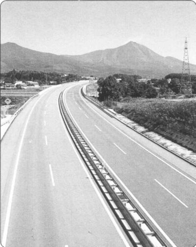
(2)一40 河東町には高速道路(こうそくどうろ)が通っています。
There is a highway in the Kawahigashi-town.
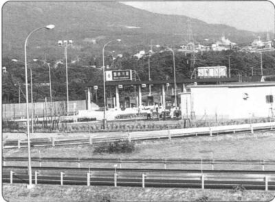
(2)一41 河東町には磐越自動車道(ばんえつじどうしゃどう)の磐梯河東(ばんだいかわひがし)インターチェンジがあります。
There is an exit,the Bandai Kawahigashi Highway Exit,in the Kawahigashi-town.
(2)一42 磐梯河東インターチェンジは、地元の負担(ふたん)でつくられたインターチェンジです。
Local people were charged with the Bandai Kawahigashi Highway Exit.
(2)一43 河東町は、日橋川(にっぱし)とせせなぎ川にはさまれた細長い町です。
The Kawahigashi-town is a rectangular town lying between the Nippashi River and theSesenagi River.
(2)一44河東町は、東西に約12キロメートル、南北の約8キロメートルの細長い町です。
The area of theKawahigashi-town from east to west is 12 kilometers,and from nrth to south is 8 kilometers.
(2)一45 河東町は、一番高いところが強清水(こわしみず)近くの596メートルです。
The highest place in Kawahigashi-town is 596 meters near Kowashimizu.
(2)一46 河東町は、一番低(ひく)いところが大坪(おおつぼ)近(ちか)くの180メートルです。
The lowest place in the Kawahigashi-town is 180 meters near Otsubo.
(2)一47 河東町は、東が高く、西の会津盆地(ばんち)へ向(むか)って傾斜(けいしゃ)している地形(ちけい)です。
The geography of the Kawahigashi-town begins with an elevated easten part which slopes down to the westen part that lies in the Aizu basin.

